Day 129. End of Woodlaw Forest – Longwood Summit. 36km. Total 2886km.
I love tenting in pine woods. Everything is dry in the morning and quickly packed up. We leave around 7.30am and are soon out of the forest to see the beautiful light just after the sunrise.
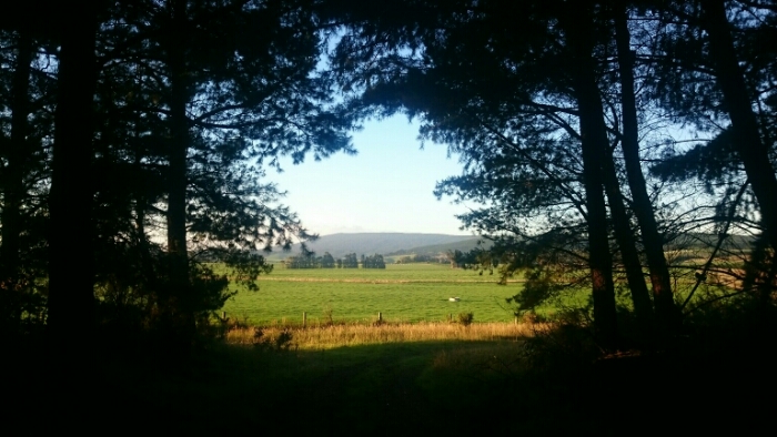


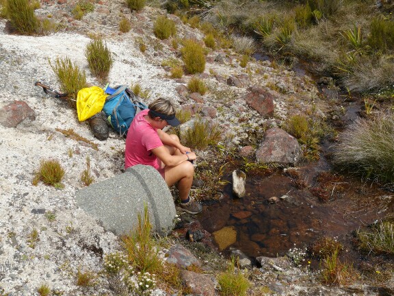
After some farmland it’s a 3.5km road connection to the next bit of trail through Island Bush. Easy walking through some forest for 4km. And soon we are out again on the road to Merrivale, a tiny town with just a few houses. Merrivale road takes us about 8km further, first amidst farmland with sheep, dear and cows. At a house we stop and ask for some water to fill up our bottles. It’s only early morning and I am already sweating and warm. Then we continue through eucalyptus trees, smelling really good.


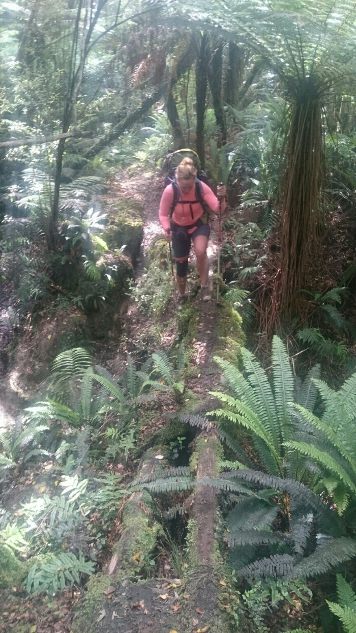
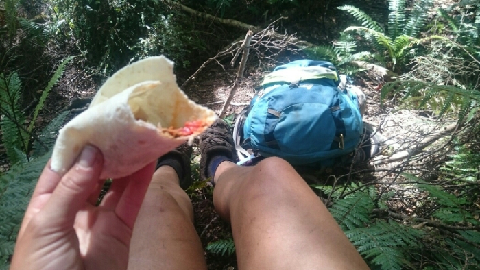
After already 19km this morning we are at 11.30am at the start of the Longwood trail. Now things are getting serious. We have to hike up to some 800m altitude again to Bald Hill. The trail is muddy and soon I am drenched from sweating. It’s hot but at least today the forest provides some shelter from the sun. We soon stop for lunch and to dry a bit.

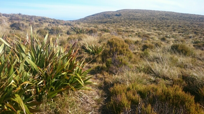
After starting again, Felix catches up on us. I already heard about him but we meet for the first time, he is also from Berlin. Once we reach the summit we enjoy the view and are soon joined by the other German couple. The view is a bit misty but seeing the coast and Stewart Island, the end feels now so close. Just a few days left!


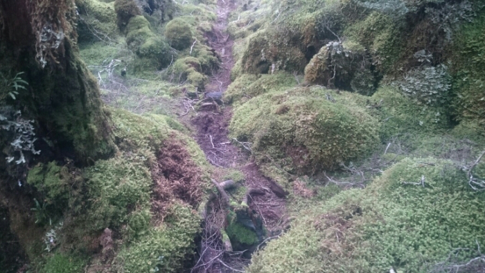
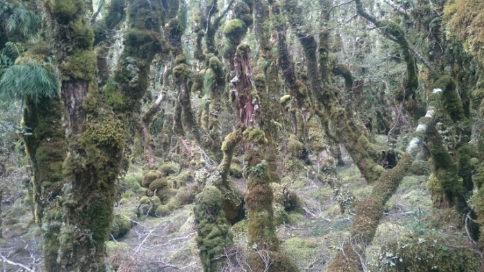
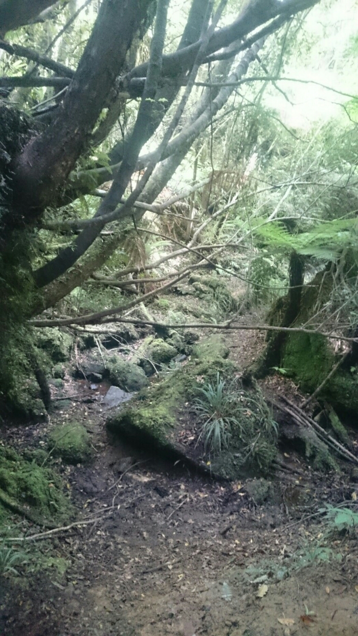
After a terrifying long descent (we will have to get back up to 750m so it’s a bad feeling to go down a lot) on an easy road, the next forest bit starts. This time with real mud! The forest is enchanted, full of beautiful green moss but also full of dirty brown mud. Didn’t miss it but it’s not bothering me too much for it to be back. It’s just a loop that’s closing, now bush and mud and in 2days beach again. Finish like I started. I like it!


The second summit wasn’t too bad in the end and we decide to continue further. It’s a long day but there aren’t many camping spots. To Martins hut it would be a 39km day, let’s see.

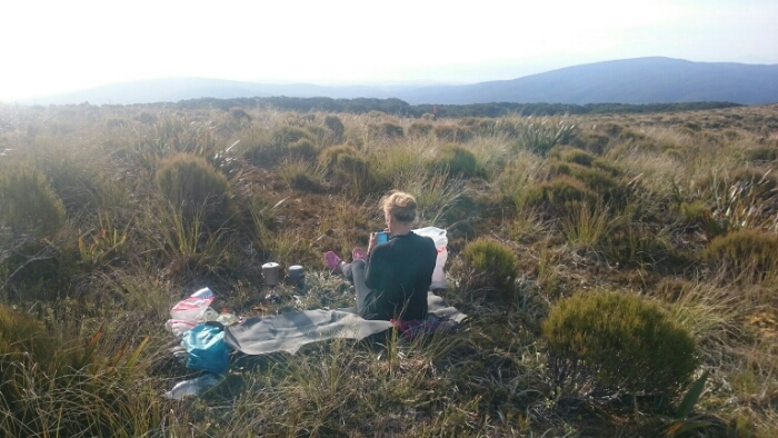
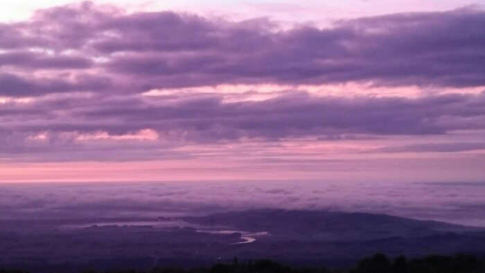
After more mud and more enjoyable hiking we reach Longwood Summit. Wow, a great view. We decide to actually camp here, seeing sunset and sunrise, hoping the weather will stay as good as we are very exposed up here! We are completely dirty and can’t wash, but, wow, what a stunning view for dinner in the evening sun!


Day 130. Longwood Summit – Colac Bay. 34km. Total 2920km.
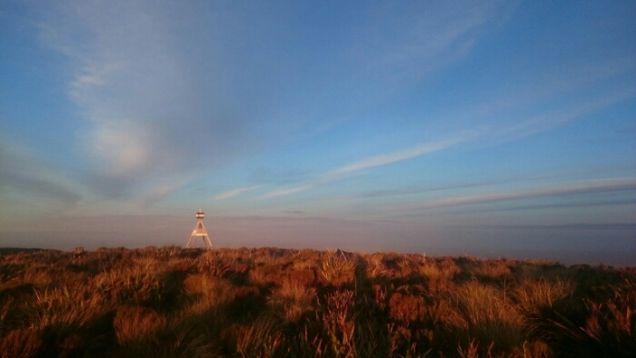
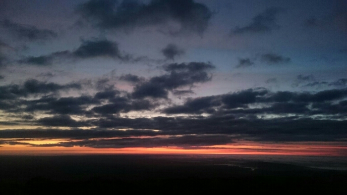
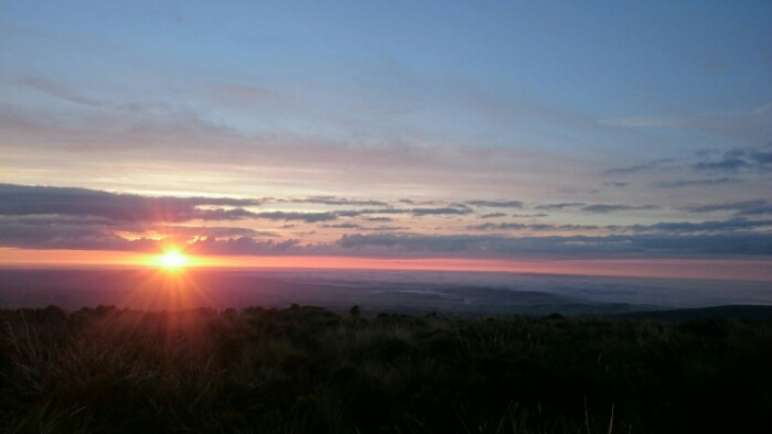
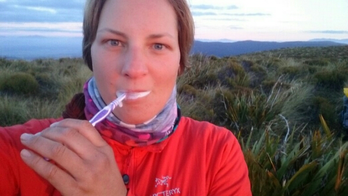
We get up at 6am for the sunrise. Cuddled up in our sleeping bags we watch the sky turn red and pink and beautiful while cooking coffee and porridge. There’s no better start into the day! We are completely dirty and muddy as we just carried some water for cooking and drinking, but there was no stream on the summit obviously to clean ourselves from the mud. And I couldn’t care less about being dirty when I see so beautiful nature!


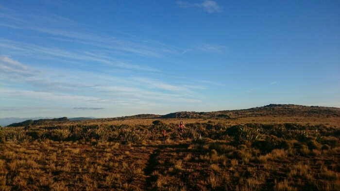
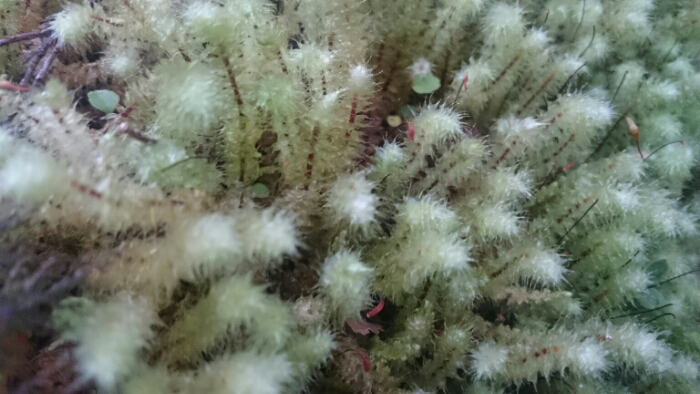
We hike in the morning sun to the next little peak nearby before descending in the bush to Martin’s hut. The old dried mud from yesterday is soon joined by fresh mud! But I don’t really care, the forest is wonderful and mossy and green.


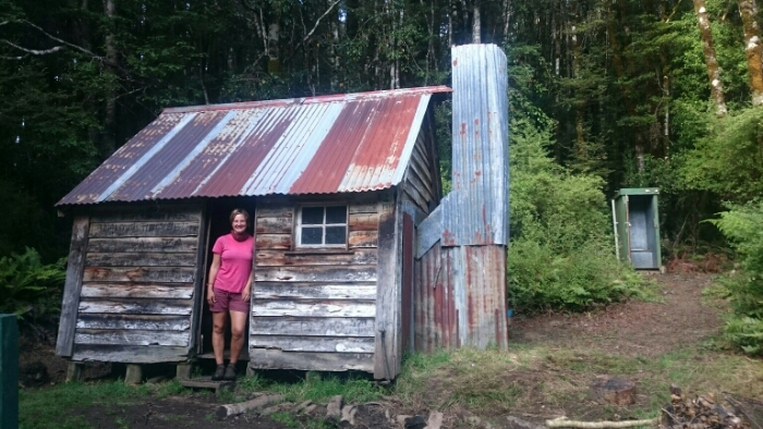
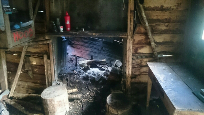
After an hour we reach Martins Hut. This tiny, old but beautiful hut is the last one on the TA! It has 4 bunks and yesterday, 5 people slept inside and 2 tented outside. I am even more happy now about our perfect camping spot.
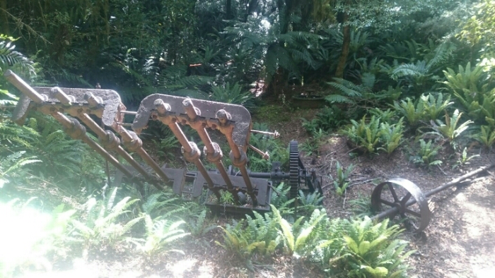
After a short break we continue the muddy trail till reaching a gravel road. One kilometer further, the next track starts, along an old water race that was used till the 1950s for gold mining purposes. In the beginning, it’s interesting to walk relatively flat along the water race in the bush. It’s an obstacle race though, every few hundred metres you have to climb up or down, walk over a stream, a log bridge, around a huge tree,…

It’s getting long and in the lunch break we realise we still have to walk some 16km before we get out of the bush. So more walking and walking and walking. Until we get to the road. A few kilometers further we reach Colac Bay, a tiny town but a Tavern / Holiday Park. For just 10$ we can camp here. First of all, we put our clothes in the washing machine and have a very long shower! The mud still isn’t completely gone (it’s sticking to my skin!!!), but I feel great! Ice cream and dinner and sleeping!…

Lucky you camped on the top! There wasn’t space left for our tents at Martins hut, so we needed to continue another 6 km when it already got dark… 😦
Enjoy your last days! Greetings from Riverton!
LikeLiked by 1 person
Hey Jasmin, ja das haben wir schon gehört. War ein echt länger Tag dann wieder für euch! Guten Endspurt nach Bluff! Vielleicht sehen wir uns in Invercargill 😉
LikeLike
Heute? 😉
LikeLiked by 1 person
Manuka oil saved me from the flu. Be kind with it 🙂
LikeLiked by 1 person
Nice post, great pics & amazing biodiversity. Some of the best trails keep you anticipating what you’ll find around the corner. This fills the bill. Muddy, messy and sparkling…love it! Keep exploring…happy trails! MG
LikeLiked by 1 person