Day 93. Upper Travers Hut – Blue Lake Hut. 15km. Total 1990km.
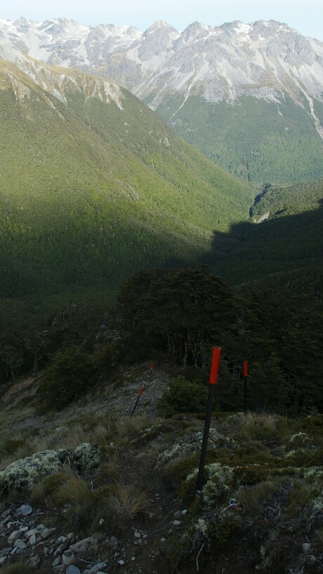
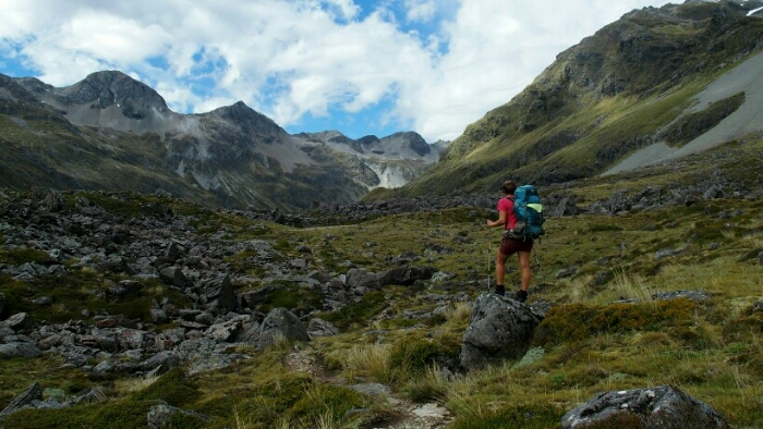
Last night was difficult, I wasn’t tired in the beginning and read a book. Then I couldn’t sleep and was so hungry. I ended up eating a muesli bar and finally sleeping afterwards. But as today is a big day, we start at 6.45am anyways. It’s a 450m altitude difference to Mount Travers Saddle from the hut and the trail is rather easy going up. Nevertheless I am soon sweating all over but the views are worth the effort!
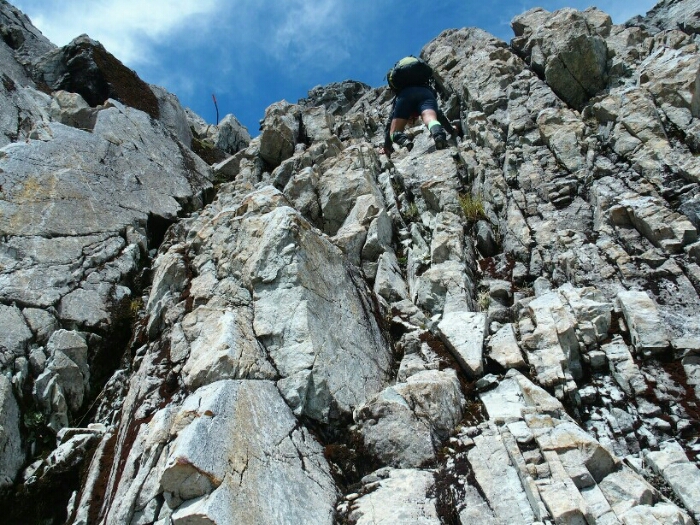
We take a lot of pictures and enjoy the time at the saddle. Luckily, because the descent is hard and very steep once we are back in the forest on the other side. The trail is slippery, overgrown in places but very well marked. We are sliding down, I fall four times on my butt – at least it’s rather soft, no stones.
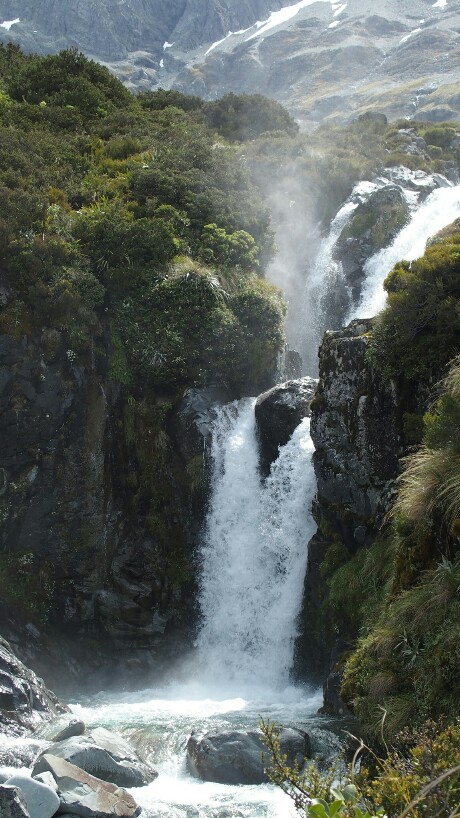
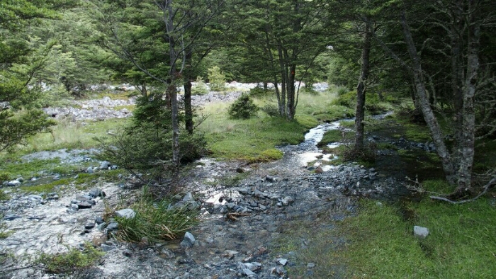
Once we are down at the river it gets easier, cruising along the river to a wonderful and very surprising gorge! It’s so well hidden that without a trail and the bridge you might just fall in there!
As we continue and do some more stream crossings I think about how far I have come in the last few months. At the very beginning of my time out I did a glacier mountaineering training and was scared of so many things, abseiling into a crevasse, gliding head first downhill and stop myself with an ice axe… There were so many scary parts to learn that I sometimes had tears in my eyes for forcing myself to overcome my fear. Today I feel so different. I have done so much more than I ever thought I would be capable of! I am not scared anylonger of anything that’s coming up. I can handle a trail that is supposedly difficult very easily. I just need to find ways to bring this confidence with me back to my “normal” life once I am done with the trail.
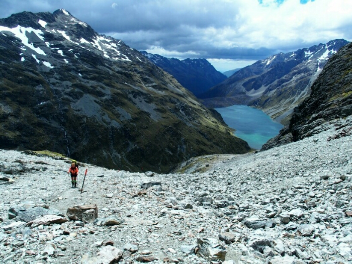
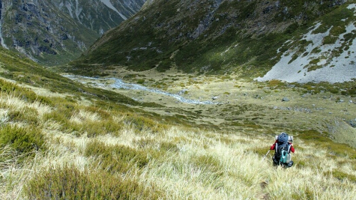
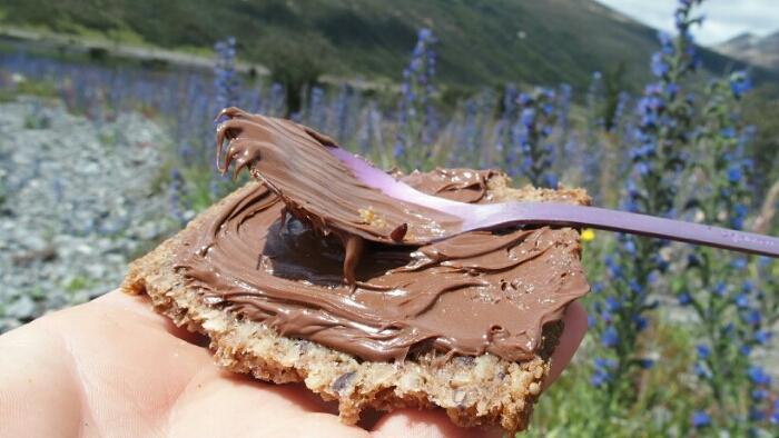
Another steep bit further we arrive at West Sabine hut. It took us just 5h instead of the 6h. So we can take another nice long lunch break with tortillas, tuna, Nutella and coffee before continuing all the way along the West Sabine River to the next hut. Initially the trail is easy with nice mountain views and then through another fairy tale forest with a few more stream crossings.
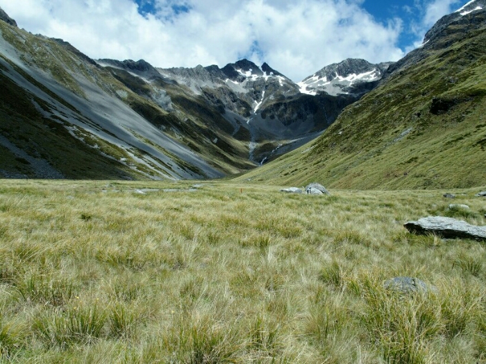
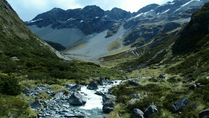
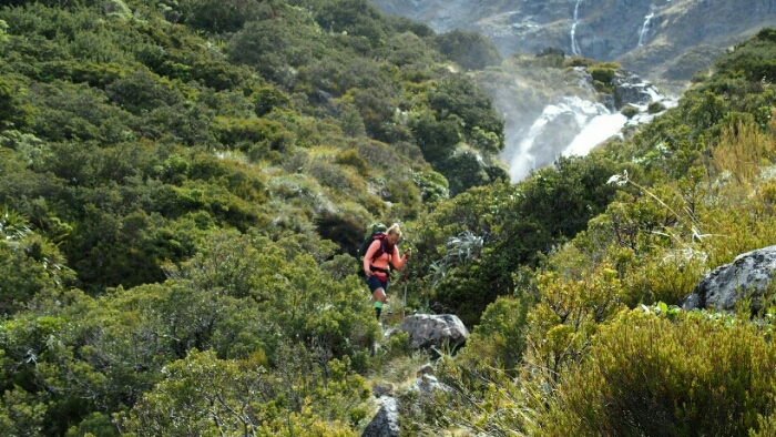
And then we get out of the forest to the most beautiful mountain view! Towering summits, river, waterfalls coming down. It’s like a postcard view!
Another hundred of pictures later we continue and it’s now again surprisingly difficult! Scrambling over rocks along an overflowing river. In between some easy boardwalks. Strange.
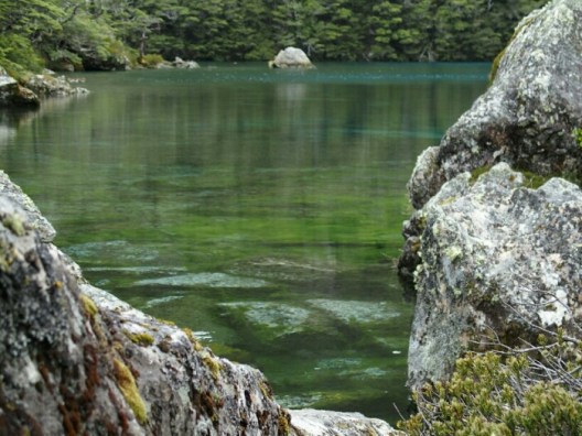
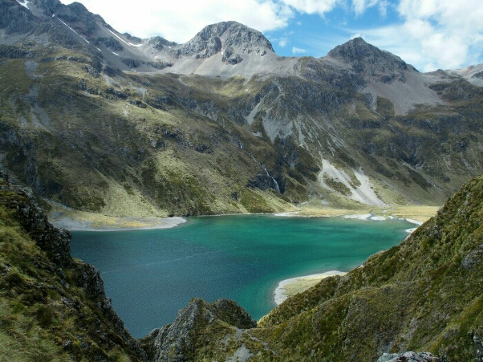
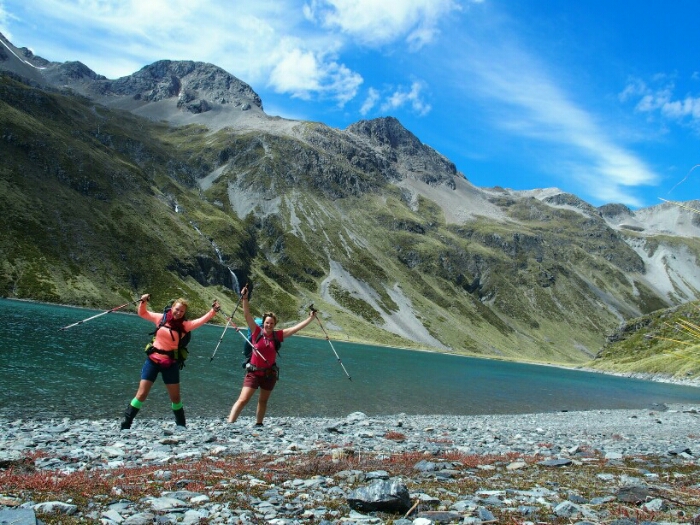
It took us 3 1/2h instead of 3h but finally we arrive at the Blue Lake Hut. Two other TA hikers are already there. We head down to the Blue Lake, one of the purest water sources in the world with an amazing colour! A perfect spot for some stretching, meditation and of course another hundreds of pictures!
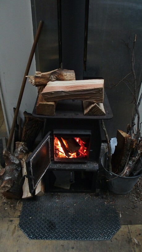
The hut is at 1,200m altitude and it gets cold soon but luckily the guys already cut some wood and light the fire. The sky is covered in clouds and we are all preparing for the announced bad weather, meaning we have to wait it out in the hut. The next part over the Waiau Pass is the most difficult (and beautiful) section of this stretch and can only be done in good conditions. Let’s see!
Day 94. Blue Lake Hut – Caroline Bivvy. 13km. Total 2003km.
A mouse kept me busy at night, hanging up everything I can find. I can hear it anyway and am afraid it’s getting our food, even hanging. After a while the rain makes more noise than the mouse and I finally fall asleep. At 6am I check the weather but it still looks bad and the short path to the toilet is under water. Next time I wake up its 8.45am! I didn’t sleep that long in a while. There are still clouds outside but also some blue sky. Can we risk going to the pass? At breakfast we realise the mouse has indeed got some of our food. A big hole in Peggy’s Tortillas and also the muesli bag has a hole. She can’t eat this anylonger so we burn it (less weight!). We should have enough to eat anyway if we make it over the pass today as we should then be in Boyle after 6 days while we had food for 8.
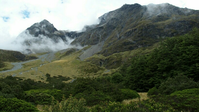
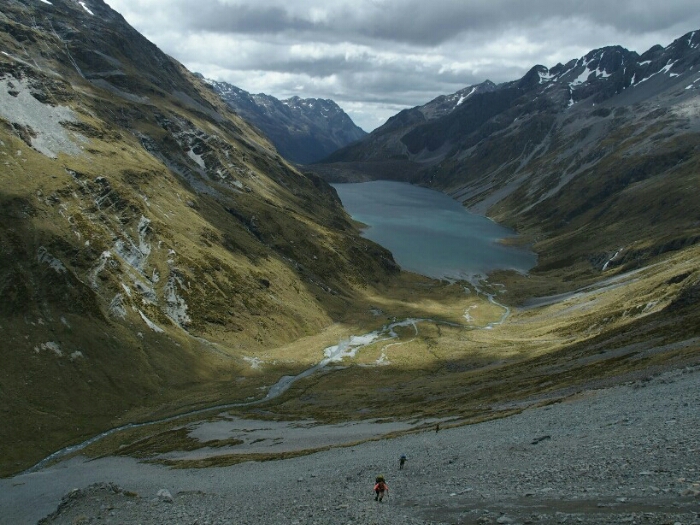
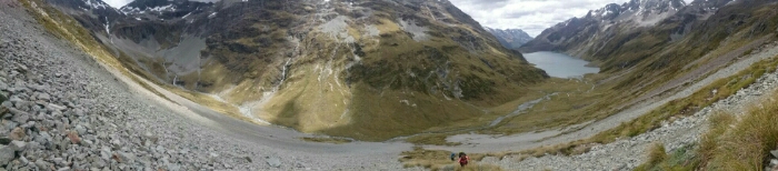
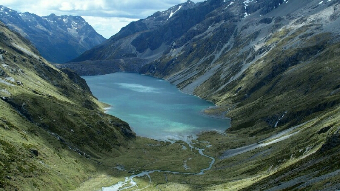
We leave the hut at 9.50am, the two guys, Mark (German) and Pal (from Iceland) shortly after us. We hike uphill first, getting nice views back on Blue Lake but as the sun is not there it’s not as beautiful on the pictures we take. I am soon sweating, hiking uphill through the forest. The mountains around us are stunning with the clouds playing around them.
After not even one hour we arrive at Lake Constance with some more climbing up and downhill again, sometimes pretty steep along the lake. The sun is finally there and we cannot believe how lucky we are! We decide to have lunch here at this beautiful spot at the lake, surrounded by the majestic mountains and are soon joined by Mark and Pal.
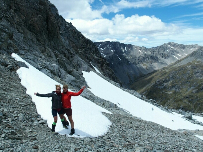
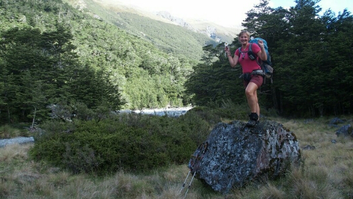
Having fun 😉
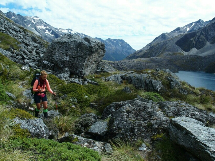
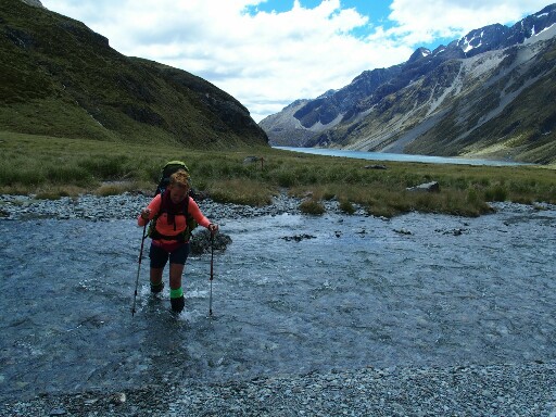
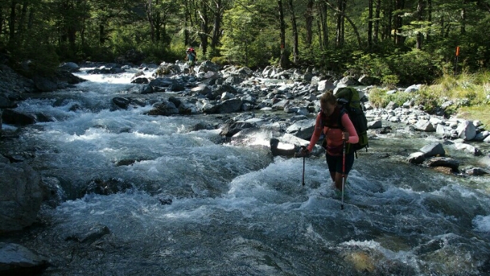
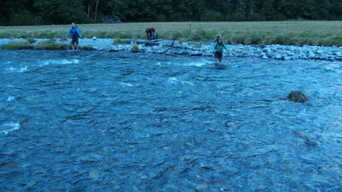
Then it’s getting serious. We head a bit further into the valley and then have to hike straight up the “wall” of one of the mountains to the Waiau Pass. Of course we have to get first our feet wet while hiking through swamp like area and on river crossings.
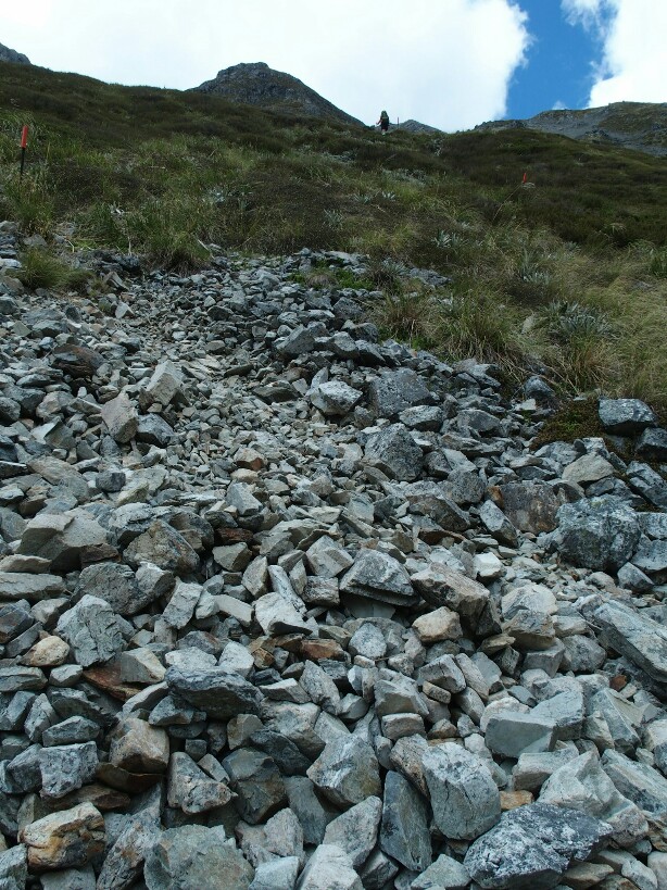
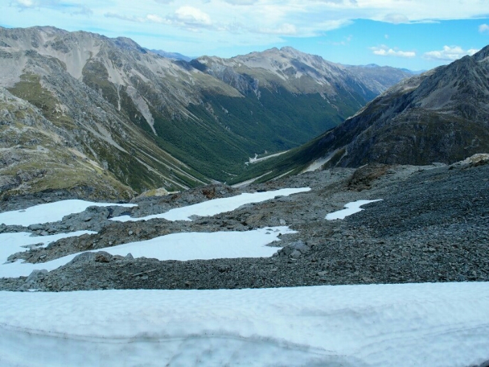
We will climb up that scree on the left hand side
My crazy idea to put some more stones in the river to cross with dry feet didn’t quite work out!
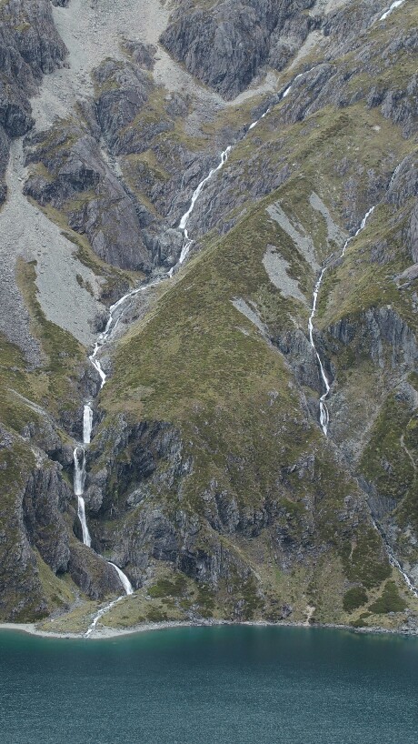
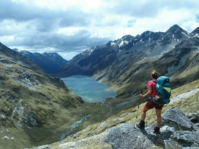
But then it’s uphill through scree. As I puff and sweat I am amazed by the view below. The river I hated just minutes ago is flowing into Lake Constance, shimmering blueish. There are so many rivers almost waterfalls coming down the mountains. Finally we reach the top and are almost blown away by the wind. On the other side, more breathtaking views and some snow!
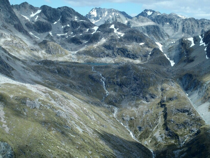
Looking down at Lake Constance
At the top of Waiau Pass
I cannot believe how lucky we are. To have this great sunshine after the heavy rain last night. To be here in this stunning spot. To be able to hike the whole Te Araroa and get to see so much of this beautiful world. I feel so thankful for living this perfect moment.
The descent then is unnerving. Its very steep and involves quite some climbing. I like it and am pretty good now at hiking fast downhill, but Peggy not yet so we take our time, hiking though closely together with Mark while Pal already ran ahead.
Once we are at the river it’s less steep but still not easy. The water is powerful and loud. After one more river crossing with wet feet we arrive at an informal campground.
It’s 4.45pm but we decide to push on to the Caroline Bivvy 5km and about 3h further. It’s only a 2 person hut but we figure we can probably sleep all 4 in there or set up our tents. So, another river crossing, a lot of big rocks and scree climbing, forests, more rivers further we are at the 2000km mark! It’s not actually marked anywhere but of course I checked whereabouts it is and celebrate with 2 flowers for my 2000km! After such a stunning day it doesn’t feel like a big deal though somehow.
Around 7pm we are finally at the Bivvy which is so old and scary we leave it to the guys and prefer setting up our tents. As we do, the sandflies get us so also cooking dinner is a quick thing, impossible to sit outside and relax after such a big day. We head in our tents and finish dinner there, I will even sleep without brushing my teeth, the sandflies are just waiting on the other side of the flysheet to eat me alive!
Day 95. Caroline Bivvy – Anne Hut. 29km. Total 2032km.
It’s been a long time I didn’t sleep in my tent. Seems I am not tough enough anylonger because I felt uncomfortable and cold although it was warmer than many other tent nights. I can also feel my body aching from the climbing yesterday with the heavy pack. As we ate for dinner first what Peggy was carrying, I still had dinner for 5 days for two in my pack plus more bread for us. Now that we are two days from Boyle it’s still heavy but I am also happy we made it in less days. As there is no shop we might also be happy about extra food to eat on place while I cannot remember what I put in the resupply box.
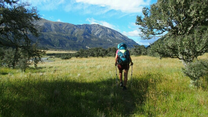
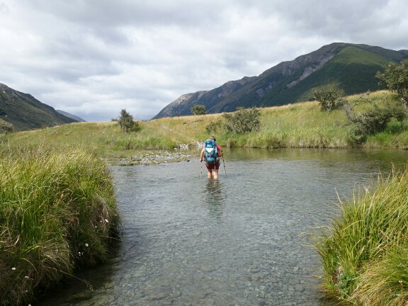
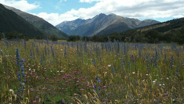
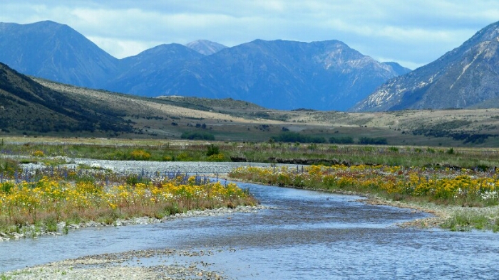
Due to the sandflies it’s a very fast morning packing up and shortly after 7am we leave for a long day, 7-9h and 25km (at least that’s what I think). The shoes are still wet so we walk just right through the first river. It’s ice cold and the sun is not yet shining down in the valley. A few river crossings later our feet are completely frozen and we just continue to hike to somehow get warmer. Finally we get out on an open flat valley and into the sunshine. It’s so nice to be in an open landscape and see the mountains around us, not trapped in a forest! Two hours in, we stop for coffee and to warm up our feet a while.
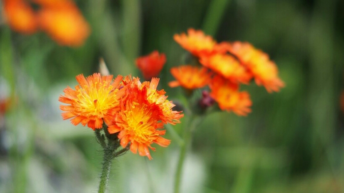
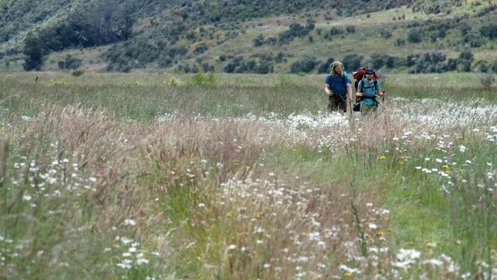
The trail continues easy, with just every now and then a river crossing. The flowers are blooming and it’s beautiful! For some time it looks like rain but we are lucky again, it’s farther away. In a flower field we stop for lunch – with yummy German bread I found in the Pack’n’Save!
After the spring, we enter into autumn, the colours changed quickly. At one of the signs we realise that it’s a 29km hike today, more than indicated in the trail notes. Well, with such an easy day it’s OK to hike four more kilometers.
We run into Mark and Pal every now and then
For the last bigger river crossing, Peggy makes a wish for a bridge – and here it comes, our swingbridge, slightly moving in the wind and scaring me! Not much later in a plain open field we can see the hut (earlier than shown in my GPS so we are wondering first if it’s our hit for real).
Anne Hut is new and wonderful, warm and clean! A few people are already there and lit a fire. Mark and Pal arrive shortly after us and the evening is busy as usual, washing ourselves, our underwear, drying our tents, stretching, writing blog, chatting….
I’m absolutely certain that you will take so much strength and confidence from the Te Araroa back to your “normal” life, so I wouldn’t be too scared of that. Even if you will find yourself in a position where you’ll have doubts, you will have an anchor point with the Te Araroa from where you can pull strength for your work!
Enjoying reading about your journey. The photos are wonderful. Hope you get more settled weather as you travel south. Typically February-March is a better month for tramping.
Just a small amendment; “Upper Traverse Hut” is called Upper Travers Hut.
Keep well and safe!


I’m absolutely certain that you will take so much strength and confidence from the Te Araroa back to your “normal” life, so I wouldn’t be too scared of that. Even if you will find yourself in a position where you’ll have doubts, you will have an anchor point with the Te Araroa from where you can pull strength for your work!
LikeLiked by 1 person
Enjoying reading about your journey. The photos are wonderful. Hope you get more settled weather as you travel south. Typically February-March is a better month for tramping.
Just a small amendment; “Upper Traverse Hut” is called Upper Travers Hut.
Keep well and safe!
LikeLiked by 1 person
Thank you! I have changed it now to Travers. Unfortunately I am already leaving in March and won’t be able to enjoy the good weather 😉
LikeLike